

Beginner's Guide to Precise Positioning with RTK GNSS

Everyone knows about GPS—technology that is used in modern devices for finding the exact location or paving the route. GPS is just one of the constellations among global satellite positioning systems or GNSS. There are other big systems: Russian GLONASS, European Galileo, and Chinese BeiDou.
Most GPS receivers, like the one in our smartphones, can only determine the position with several meters accuracy. It is sufficient when you need to track your Uber. But is it sufficient for autonomous driving? Luckily, there’s a technique that enables accuracy down to 1-2 centimeters. It is called Real-Time Kinematic or RTK. This GNSS technology is used to improve positioning data received from satellite constellations.
Positioning with GNSS
Global Navigation Satellite Systems encompasses constellations of satellites that continuously transmit signals to Earth. These signals include positioning and timing data. The receiver needs to collect information from at least three satellites to determine its position on the surface, and at least four satellites to determine it in three dimensions. GNSS-compatible devices can receive signals not only from the GPS constellation, but from GLONASS, Galileo, and BeiDou too.
If you want to learn more about the basic principles of GNSS, check out this video:
You might think that high-accuracy positioning is only needed in areas such as land surveying, civil engineering, mining, and more. But it turns out that precise positioning can be applied in many different areas. Positioning can be used in three main ways: determining coordinates, tracking your position, and for navigation. All of the above include a host of applications.
For example, precise coordinates are needed when it comes to creating high-accuracy maps with a drone. Scientists can use positioning systems to track animals or to monitor landscape changes like melting glaciers or the movement of coral reefs. Precision technologies are also used for machinery and robotic guidance and help vehicles to track a defined path. These and many other applications require centimeter-level accuracy.
Positioning Technique Enabling Centimeter Accuracy
All GNSS devices receive signals with ionospheric, tropospheric, and satellite clock errors. RTK technique can eliminate these errors and provide high-accuracy solutions.
Two receivers are used in RTK: a base and a rover. The base, mounted on a precisely known location, measures errors and sends corrections to the moving rover. Using the correction data from the base station, the rover can provide centimeter accuracy in real-time.
You don't need to have your rover and base connected in real-time if you use Post-Processed Kinematic or PPK. The main difference between the two methods is that in PPK all data is processed afterward and doesn’t require a real-time link between the base and rover.
For a long time, RTK GPS devices were expensive and extremely complicated to integrate and use. But things have changed. There are GPS devices that don't cost you a fortune and a non-professional user can understand.
You don't need to have specialized education if you want to collect accurate positions of terrestrial points. For instance, you can conduct a boundary survey of your area all by yourself, instead of calling a surveyor.
Applications Requiring Centimeter Accuracy
GNSS based technologies can be used in different areas of modern life. Let's take a brief look at some popular applications:
Aerial Mapping
People use drones because they help to do work quickly and efficiently. A drone captures multiple photos of the area which then can be used to create 3D models of the terrain. To build a geographically accurate map you need to mark up ground control points (GCP). What exactly is a ground control point? GCP is a marker on the ground with known precise coordinates. The surveyor places GCPs on the area and uses RTK receiver to find the exact coordinates of each of them. Later the GCPs will be used to geo-reference the final map.
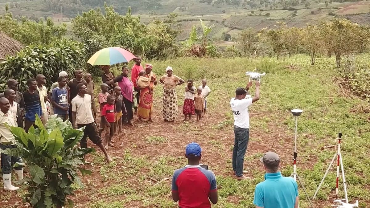
Drone mapping with GCPs in Congo. Credits: the Geography Department of the UCLouvain
Precision Agriculture
GPS receivers help farmers solve tasks efficiently. GPS-based systems can reduce expenses on a farm and save working time. For example, RTK technology allows farmers to spray fertilizers only where necessary, thereby minimizing the waste of resources. Or instead of buying expensive auto-steering systems for tractors, farmers can use cost-effective RTK receivers for guiding and steering the machinery in real-time.
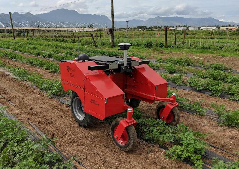
Digital Farmhand robot created by Australian Centre for Field Robotics
Precise Navigation
Autonomous robots are used for different purposes: agriculture, cleaning, research of inaccessible terrains, and more. Precise navigation is the key when it comes to guidance. RTK technology helps machines to precisely navigate according to a defined trajectory. For example, RTK GNSS receiver Reach RS+ helps an autonomous robot accurately paint football pitches.
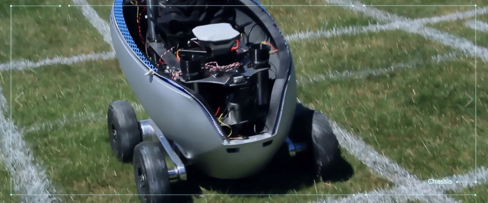
Screenshot from Nissan Pitch R Case Film shot by UNIT9
How to Choose a Receiver
When it comes to choosing an RTK receiver it is easy to get confused. There are a lot of new options these days. Most receivers on the market cost at least several thousand dollars. Deciding on which device to pick can be hard. Let’s figure out how to choose a suitable RTK receiver.
All GNSS receivers can be divided into two categories: multi-band and single-band. Both single-frequency and dual-frequency receivers have the same level of accuracy under ideal conditions. The choice of receiver depends on your case and budget.
A single-band receiver is a good choice for working in the field under a clear sky view and your base station isn't far away. A multi-band receiver is able to achieve centimeter precision even in urban areas despite the various obstacles and get the fix solution in ~5 seconds.
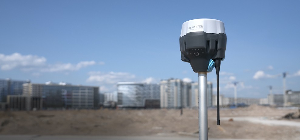
Emlid has two receivers—Reach RS+ and Reach RS2.
Reach RS+ is a single-band multi-GNSS receiver with a built-in LoRa radio. For RTK mode, you need two receivers: a base station and a rover. The base can be either the second receiver or the NTRIP service. Reach RS+ can also work with other receivers.
Reach RS2 is a multi-band RTK GNSS receiver that gets a fixed solution in just a few seconds. It works stably even in difficult conditions like a dense forest or an urban area. Receiving signals at a large number of frequencies, Reach RS2 sends corrections faster than Reach RS+ and can be removed up to 100 km from the base station.
How to Use Reach
Reach RS+ is a robust single-band RTK GNSS receiver that only costs $799. Reach receivers come with the ReachView app that doesn't require an internet connection. ReachView has a simple and user-friendly interface and is available on both Android and iOS.
By using the app, you can manage data collection: find centimeter-precise coordinates on the ground, save them, and assign names to each point. Research results can be exported to software like ArcGIS or AutoCAD. You can also create a project in mapping software, then export data and find exact physical locations in your area. Or, if you use PPK, record raw data for post-processing in open-source RTKLIB.
For your survey, you need to install the ReachView app, connect to Reach via Wi-Fi, and then set up base and rover correction. Once you have connected to the Reach receiver via the app you can set up correction between receivers. Next, you can configure RTK settings in ReachView. Watch this guide to understand how to set up the Reach rover and Reach base station and how to make them work over LoRa radio:
You can buy RTK GNSS receivers from Emlid or other brands in RobotShop online store.
To learn how well Reach fits for your project, ask your questions on RobotShop Community Forum.
Thanks for helping to keep our community civil!
This post is an advertisement, or vandalism. It is not useful or relevant to the current topic.
You flagged this as spam. Undo flag.Flag Post
Your post is currently under review by our moderation team. The review process usually takes up to 48 business hours.
You can track your post's status in the "My Content" section of your profile. Once approved, it will be published and visible to others.

Thank you for contributing to our community!