Whirligig

Posted on 13/02/2010 by geirandersen
Modified on: 13/09/2018
Project
Press to mark as completed
Introduction
This is an automatic import from our previous community platform. Some things can look imperfect.

If you are the original author, please access your User Control Panel and update it.

I might be breaking some LMR rules, but this robot was built on my spare time while funded by the University of Oslo  and my employer APPLY Sørco, covering the hardware cost.This robot was built to make bathymetric charts of lakes in Norway. It was initiated by my brother who is a professor at UiO. Totally disregarding my lack of engineering skills, an over estimating my programming / electronic skills he commissioned me to build ‘Whirligig’.The robot navigates according to GPS coordinates ...


Whirligig

I might be breaking some LMR rules, but this robot was built on my spare time while funded by the University of Oslo  and my employer APPLY Sørco, covering the hardware cost.This robot was built to make bathymetric charts of lakes in Norway. It was initiated by my brother who is a professor at UiO. Totally disregarding my lack of engineering skills, an over estimating my programming / electronic skills he commissioned me to build ‘Whirligig’.
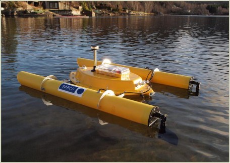
The robot navigates according to GPS coordinates stored as waypoints on an onboard SD card. Logging GPS and water depths along its rout (every 10 sec.). The estimated runtime is 24 hour before it needs recharging of the 7 batteries.

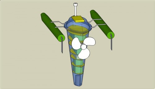
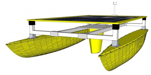
As you can see from the attached PDF file (in Norwegian only, sorry) am I working on a second version of this robot. This time using solar panels and a catamaran hull for more flexibility on payload and stability.

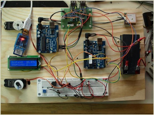
This is a block diagram of the control system

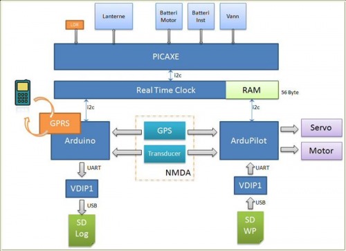
The original plan was using an ardupilot, but I ended up with using a regular arduino and building my own navigation software.

Google sketchup of the designSome images from the hull build 

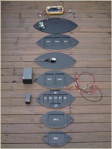
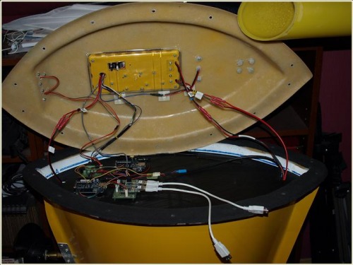
All the decks laid out showing the position of motor and instrumentation batteries

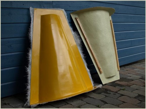
Testbed for instrumentation and navigation check.

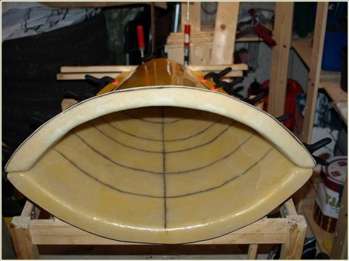
Instrumentation mounted in top deck and lid.

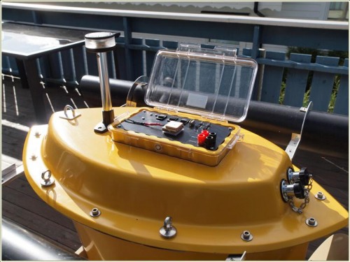
Waterproof box enbeded in the lid. Holding SD cards for waypoint and log data, GPS and charging plugs.

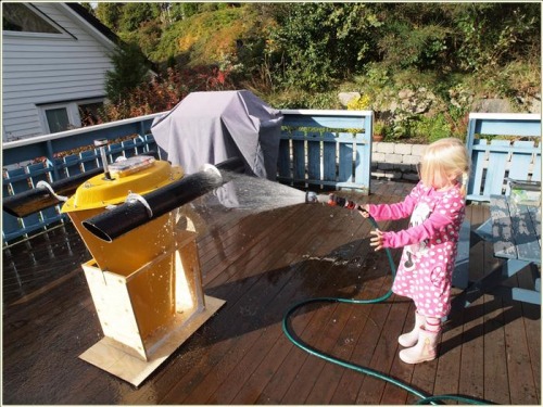
My daughter doing water intrusion test :-)


I am currently building a Mark II version with a complete new hull. This version will be self-contained with power from solar cells and upload data and getting waypoints via a GPRS shield.
This version will also have a full-size  computer onboard, the fit PC2.

Mapping water depths in lakes

  • Actuators / output devices: Propeller, 600 RPM gear motor
  • CPU: Picaxe 28x1, Arduino
  • Power source: 7 12V 12Ah batteries
  • Programming language: Picaxe basic, Arduino C++
  • Sensors / input devices: GPS, Transducer
  • Target environment: Lakes, shore lines
Flag this post

Thanks for helping to keep our community civil!


Notify staff privately
It's Spam
This post is an advertisement, or vandalism. It is not useful or relevant to the current topic.

You flagged this as spam. Undo flag.Flag Post